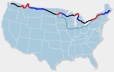
| NT Section 1 | May 26 - June 8 | Anacortes WA - Sandpoint ID |
| NT Section 2 | June 9 - June 19 | Sandpoint ID - Cut Bank MT |
| NT Section 3 | June 20 - July 1 | Cut Bank MT - Minot ND |
| NT Section 4 | July 2 - July 7 | Minot ND - Moorhead MN |
| NT Section 5 | July 8 - July 11 | Moorhead MN - Grand Rapids MN |
| Hayward Sortie | July 12 - July 16 | Grand Rapids MN - Hayward WI |
| North Lakes 1 | July 17 - July 20 | Hayward WI - Escanaba MI |
| North Lakes 2 | July 21 - July 24 | Escanaba MI - Mackinaw City MI |
| North Lakes 3 | July 25 - July 28 | Mackinaw City MI - Luther MI |
| Lake Erie Connector | July 29 - August 8 | Luther MI - Niagara Falls ON |
| NT Section 10 | August 9 - August 15 | Niagara Falls ON - Middlebury VT |
| NT Section 11 | August 16 - August 27 | Middlebury VT - Bar Harbor ME |
| Conclusion | ||
| Miles |
I've wanted to do an Adventure Cycling tour for years. The long, self-supported, group tours that ACA does are just my cup of tea. Having a pre-planned route and a tour leader to handle all the arrangements seems a nice alternative to doing all the legwork myself.
Up until now, the problem has been talking my boss into letting me disappear for three months. But I became eligible for retirement when I turned 55 on May 2. The only reason I didn't retire then was to help finish the project I'm designing at work. The deal I negotiated is that I leave for three months on my cycling vacation, then return for a couple of months to finish the test and verification phase of the product, then retire for good.
It turned out that yes, with a large enough memory card I could easily load enough detail maps to cover the entire cross-country tour. However the waypoints to specify the route cannot be stored in the memory card, but only in internal memory. You're limited to something like 400 waypoints, not nearly enough to cover a 4500-mile tour. I wasn't interested in lugging around a 10-pound laptop computer to reload waypoints every couple weeks. Also, it turns out that the "street routing" does not work with waypoints. The GPS finds its own way between beginning and ending points, typically via the freeway, which is not useful for a bicycle tour.
During the tour I kept a diary on my hand-held Palm Pilot computer. Since it is fairly painful to input text using the stylus and "Graffiti" the diary is a bit terse. For this web journal I have filled in some extra explanation and details as I recall them a year later.
Last updated November 22, 2021